
forum4travel

The Annapurna Base Camp (ABC) Trek is one of Nepal’s most iconic trekking experiences, offering breathtaking views of the Annapurna massif, charming villages, and diverse landscapes. For first-time trekkers, understanding the Annapurna Base Camp trek map and route is essential for planning a safe, enjoyable, and memorable adventure. This guide will explain the ABC trekking route, highlights, daily itinerary, distances, altitudes, and important tips to make your trek successful.
Key points on the ABC trek map include:
By following the ABC trek map, first-time trekkers can clearly plan daily distances, resting points, and acclimatization stops.
Day 1: Pokhara to Nayapul and Trek to Tikhedhunga
Distance: 8 km | Altitude: 1,540m
The trek begins from Nayapul, a 1.5-hour drive from Pokhara. Walk along the Modi River through terraced fields, small villages, and suspension bridges to reach Tikhedhunga, known for its steep uphill climb.
Day 2: Tikhedhunga to Ghorepani
Distance: 12 km | Altitude: 2,850m
This section includes the famous stair climb of Ulleri. Ghorepani is a beautiful village and base for the Poon Hill sunrise hike, providing panoramic views of Dhaulagiri, Annapurna South, and Machhapuchhre.
Day 3: Ghorepani to Tadapani via Poon Hill
Distance: 10 km | Altitude: 2,630m
Early morning trek to Poon Hill for sunrise is highly recommended. Descend back to Ghorepani and trek through rhododendron forests to reach Tadapani, a quiet and scenic village.
Day 4: Tadapani to Chomrong
Distance: 8 km | Altitude: 2,170m
Trek through dense forests, waterfalls, and charming villages to reach Chomrong, the gateway to the upper Annapurna region. This village offers amazing views of Annapurna South and Machhapuchhre.
Day 5: Chomrong to Dovan
Distance: 10 km | Altitude: 2,600m
The trail ascends through bamboo and rhododendron forests. Cross the Kimrong Khola and continue uphill to Dovan, a small settlement perfect for overnight stay.
Day 6: Dovan to Deurali
Distance: 8 km | Altitude: 3,200m
Trek continues uphill with stunning mountain views, passing through Bamboo and Himalaya. Arrive at Deurali, where trekkers acclimatize before the final ascent.
Day 7: Deurali to Annapurna Base Camp
Distance: 12 km | Altitude: 4,130m
The final ascent is challenging but rewarding. Trek through rocky paths, moraine landscapes, and glaciers to reach Annapurna Base Camp. Enjoy 360-degree views of Himalchuli, Annapurna I, Machhapuchhre, and Annapurna South.
Day 8: Annapurna Base Camp to Bamboo
Distance: 15 km | Altitude: 2,310m
Begin descending via Dovan, enjoying landscapes from a different perspective. Overnight at Bamboo.
Day 9: Bamboo to Jhinu Danda
Distance: 10 km | Altitude: 1,780m
Descend further to Jhinu Danda, famous for natural hot springs – perfect for relaxing tired muscles.
Day 10: Jhinu Danda to Nayapul and Drive to Pokhara
Distance: 12 km | Altitude: 1,070m
Complete the trek by reaching Nayapul and drive back to Pokhara, celebrating the successful trek.
Book your Annapurna Base Camp trek with Himalayan Asia Treks today for a guided, well-organized adventure that ensures comfort, safety, and the best trekking experience possible.
Understanding the Annapurna Base Camp Trek Map
The Annapurna Base Camp trek map shows the journey starting from Pokhara, the gateway to the Annapurna region, through traditional Gurung villages, lush forests, and high mountain trails leading to the base of the Annapurna Massif. The ABC trek is a loop trek, allowing trekkers to explore the stunning Machhapuchhre (Fishtail) Mountain, Himalchuli, and Annapurna South, before descending back to Pokhara.Key points on the ABC trek map include:
- Pokhara – Starting point (transport hub)
- Naya Pul – Trekking entry point
- Ghorepani & Poon Hill – Famous for sunrise views (optional detour)
- Tadapani – Mountain village with lush rhododendron forests
- Chomrong – Gateway to the higher Annapurna region
- Himalaya & Bamboo – Scenic villages en route
- Deurali & Machhapuchhre Base Camp – Challenging high-altitude sections
- Annapurna Base Camp (ABC) – Final destination at 4,130m
- Sinuwa & Jhinu Danda – Descent through hot springs
- Nayapul & Pokhara – Trek completion
By following the ABC trek map, first-time trekkers can clearly plan daily distances, resting points, and acclimatization stops.
Annapurna Base Camp Trek Route Overview
The ABC trek route covers approximately 115 km round trip from Pokhara, depending on the entry and exit points. Most first-time trekkers prefer the standard 10–12 day itinerary, which balances trekking pace with acclimatization.Day-by-Day Route Guide
Day 1: Pokhara to Nayapul and Trek to Tikhedhunga
Distance: 8 km | Altitude: 1,540m
The trek begins from Nayapul, a 1.5-hour drive from Pokhara. Walk along the Modi River through terraced fields, small villages, and suspension bridges to reach Tikhedhunga, known for its steep uphill climb.
Day 2: Tikhedhunga to Ghorepani
Distance: 12 km | Altitude: 2,850m
This section includes the famous stair climb of Ulleri. Ghorepani is a beautiful village and base for the Poon Hill sunrise hike, providing panoramic views of Dhaulagiri, Annapurna South, and Machhapuchhre.
Day 3: Ghorepani to Tadapani via Poon Hill
Distance: 10 km | Altitude: 2,630m
Early morning trek to Poon Hill for sunrise is highly recommended. Descend back to Ghorepani and trek through rhododendron forests to reach Tadapani, a quiet and scenic village.
Day 4: Tadapani to Chomrong
Distance: 8 km | Altitude: 2,170m
Trek through dense forests, waterfalls, and charming villages to reach Chomrong, the gateway to the upper Annapurna region. This village offers amazing views of Annapurna South and Machhapuchhre.
Day 5: Chomrong to Dovan
Distance: 10 km | Altitude: 2,600m
The trail ascends through bamboo and rhododendron forests. Cross the Kimrong Khola and continue uphill to Dovan, a small settlement perfect for overnight stay.
Day 6: Dovan to Deurali
Distance: 8 km | Altitude: 3,200m
Trek continues uphill with stunning mountain views, passing through Bamboo and Himalaya. Arrive at Deurali, where trekkers acclimatize before the final ascent.
Day 7: Deurali to Annapurna Base Camp
Distance: 12 km | Altitude: 4,130m
The final ascent is challenging but rewarding. Trek through rocky paths, moraine landscapes, and glaciers to reach Annapurna Base Camp. Enjoy 360-degree views of Himalchuli, Annapurna I, Machhapuchhre, and Annapurna South.
Day 8: Annapurna Base Camp to Bamboo
Distance: 15 km | Altitude: 2,310m
Begin descending via Dovan, enjoying landscapes from a different perspective. Overnight at Bamboo.
Day 9: Bamboo to Jhinu Danda
Distance: 10 km | Altitude: 1,780m
Descend further to Jhinu Danda, famous for natural hot springs – perfect for relaxing tired muscles.
Day 10: Jhinu Danda to Nayapul and Drive to Pokhara
Distance: 12 km | Altitude: 1,070m
Complete the trek by reaching Nayapul and drive back to Pokhara, celebrating the successful trek.
Key Highlights Along the Annapurna Base Camp Trek Route
- Poon Hill Sunrise – Panoramic views of Annapurna and Dhaulagiri range.
- Chomrong Village – Traditional Gurung culture and architecture.
- Machhapuchhre Base Camp – Close-up views of the iconic Fishtail Mountain.
- Natural Hot Springs at Jhinu Danda – Perfect for relaxation.
- Annapurna Base Camp – Stunning 360-degree Himalayan panorama.
Annapurna Base Camp Trek Tips for First-Time Trekkers
- Best Time to Trek: March to May and September to November for clear skies and moderate temperatures.
- Trek Difficulty: Moderate to challenging, suitable for beginners with a reasonable fitness level.
- Packing Essentials: Layered clothing, trekking boots, sleeping bag, trekking poles, water purification, and sunscreen.
- Acclimatization: Essential to prevent altitude sickness, especially at Dovan and Deurali.
- Navigation: Follow the ABC trek map and local guides; trails are well-marked but some sections can be confusing.
Annapurna Base Camp Trek Distance and Altitude
The ABC trek distance is roughly 115 km round trip, with altitudes ranging from 1,070m at Nayapul to 4,130m at Annapurna Base Camp. Daily trekking distances vary between 8–15 km, depending on the itinerary and acclimatization stops.Conclusion
The Annapurna Base Camp trek map and route provides first-time trekkers with a clear understanding of this incredible journey. By planning carefully, following the recommended route, and respecting altitude and weather conditions, trekkers can enjoy a safe, scenic, and unforgettable experience in the heart of the Himalayas.Book your Annapurna Base Camp trek with Himalayan Asia Treks today for a guided, well-organized adventure that ensures comfort, safety, and the best trekking experience possible.
1 Replies
·
516 views

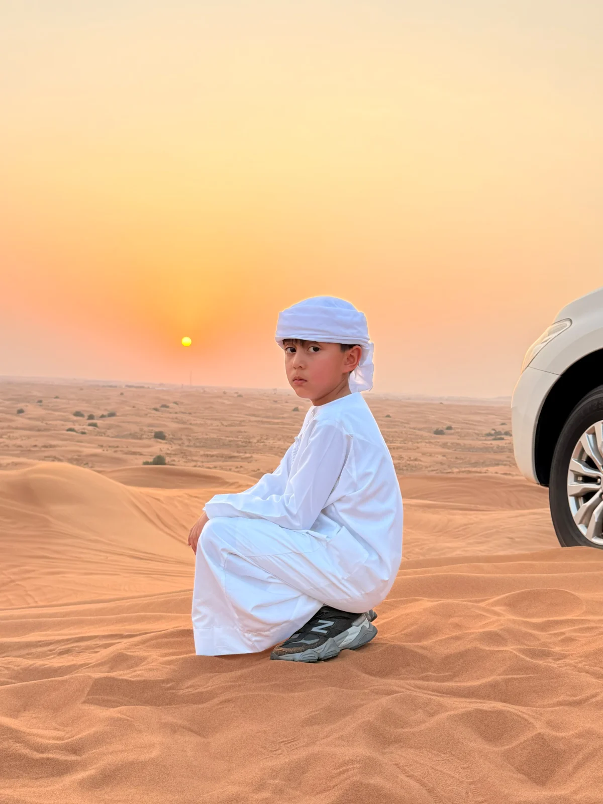
Experience the best of Dubai with our city tours and desert adventures. Explore the city’s iconic landmarks, then escape to the golden dunes for an unforgettable desert safari. Enjoy an exciting dune-bashing ride with our experienced drivers and discover a different side of Dubai beyond the city.
0 Replies
·
21 views


Hi, I’m Dala from Tapiri Tours, offering custom trips in Egypt: flights, hotels, tours, and more.
Contact on WhatsApp: +201011520592
Website: https://tapiri-7.com/
Let us help you explore Egypt!
Contact on WhatsApp: +201011520592
Website: https://tapiri-7.com/
Let us help you explore Egypt!
1 Replies
·
471 views

Travel Company: Dav Safaris
Website: www.davsafaris.com
Email: info@davsafaris.com
Tel: +256757795781 or +256701412430
Combining Rwanda Gorilla Trekking with Egypt Tour offers tourists an opportunity to witness the pyramids of Egypt and the endangered mountain gorillas of Rwanda. Let’s help you plan your Egypt Tour and Rwanda gorilla trekking with detailed itineraries, travel tips, and accommodation options for an Egypt Tour and Rwanda gorilla trekking experience.
How to Plan Rwanda Gorilla Trekking with Egypt Tour
Day 1: Arrival in Kigali, Rwanda
Your adventure begins with your arrival in Kigali, the vibrant capital of Rwanda. After clearing customs and immigration, you’ll be greeted by your guide who will transfer you to your hotel. Kigali is known for its cleanliness and safety, making it a pleasant start to your journey. Spend the afternoon exploring the city, visiting the Kigali Genocide Memorial to understand Rwanda’s history, and enjoying a leisurely dinner at one of the city’s top restaurants. Accommodation options range from the budget-friendly Discover Rwanda Youth Hostel to the luxurious Kigali Serena Hotel.
Day 2: Transfer to Volcanoes National Park Rwanda
After breakfast, embark on a scenic drive to Volcanoes National Park, home to the endangered mountain gorillas. The journey takes you through Rwanda’s picturesque countryside, with rolling hills and lush landscapes. Upon arrival, check into your lodge and prepare for the next day’s gorilla trekking adventure. Accommodation options include the budget-friendly Kinigi Guest House, the midrange Le Bambou Gorilla Lodge, and the luxurious Bisate Lodge. Enjoy a hearty dinner and get a good night’s rest in preparation for an early start.
Day 3: Gorilla Trekking in Volcanoes National Park
Today is the highlight of your Rwanda adventure gorilla trekking! After an early breakfast, you’ll head to the park headquarters for a briefing on the trekking rules and guidelines. Accompanied by experienced guides, you’ll trek through the dense forest in search of a gorilla family. The trek can be challenging, but the reward of observing these magnificent creatures in their natural habitat is truly unforgettable. Spend an hour with the gorillas, watching their interactions and behaviors. Return to your lodge for a well-deserved rest and share your experiences over dinner.
Day 4: Transfer to Kigali and Fly to Cairo, Egypt
After breakfast, you’ll drive back to Kigali for your flight to Cairo, Egypt. Upon arrival in Cairo, you’ll be transferred to your hotel. Cairo, the bustling capital of Egypt, is a city of contrasts, where ancient history meets modern life. Spend the evening relaxing at your hotel or exploring the vibrant streets of Cairo on your Egypt Tour. Accommodation options range from the budget-friendly Dahab Hostel to the luxurious Nile Ritz-Carlton.
Day 5: Explore the Pyramids of Giza and Sphinx
Start your Egypt Tour adventure with a visit to the iconic Pyramids of Giza and the Sphinx. These ancient wonders are a testament to Egypt’s rich history and architectural prowess. Your guide will provide fascinating insights into the history and significance of these structures. After exploring the pyramids, enjoy a traditional Egyptian lunch at a nearby restaurant. In the afternoon, visit the Egyptian Museum to see a vast collection of artifacts, including the treasures of Tutankhamun. Return to your hotel for a relaxing evening on an Egypt Tour.
Day 6: Fly to Luxor for River Nile Cruise
Today, you’ll fly to Luxor, the gateway to the Nile River and its ancient temples. Upon arrival, you’ll board your Nile cruise ship, which will be your home for the next few days. Enjoy a delicious lunch on board as you sail towards the first stop, the Temple of Karnak. Explore this vast complex, dedicated to the god Amun, and marvel at its impressive columns and statues. Return to the ship for dinner and an evening of relaxation.
Day 7-9: Nile Cruise and Explore Ancient Temples
Over the next three days, you’ll cruise along the Nile, stopping at various ancient sites. Visit the Valley of the Kings, where the tombs of pharaohs, including Tutankhamun, are located. Explore the Temple of Hatshepsut, dedicated to one of Egypt’s few female pharaohs. Other highlights include the temples of Edfu and Kom Ombo. Each day, enjoy Egypt Tour guided tours, delicious meals on board, and the stunning scenery of the Nile River. In the evenings, relax on the deck and watch the sunset over the river.
Day 10: Return to Cairo and Departure
On your final day, you’ll return to Cairo for your departure flight. Depending on your flight time, you may have the opportunity to do some last-minute shopping or visit additional sites in Cairo. Reflect on the incredible experiences of your journey, from the gorilla trekking in Rwanda to the ancient wonders of Egypt. Your Egypt Tour adventure concludes with your transfer to the airport for your flight home.
Are There Animals to See on an Egypt Tour?
Yes, there are animals to see on an Egyptian safari. An Egypt Tour offers a unique opportunity to see a variety of animals in their natural habitats. From the majestic Nile crocodile to the elusive desert fox, Egypt’s diverse ecosystems are home to a wide range of wildlife. You can also spot various bird species, including the beautiful Egyptian vulture and the striking African fish eagle. Whether you’re exploring the Nile River or venturing into the Western Desert, an Egypt Tour promises exciting wildlife encounters.
Can You Do an Egypt Tour from Cairo?
Yes, you can do an Egypt Tour from Cairo. Cairo serves as a convenient starting point for an Egypt Tour. From Cairo, you can easily access various safari destinations, including the Western Desert, the Nile River, and the Red Sea coast. Dav Safaris offers day trips and multi-day safaris that depart from Cairo, making it easy to incorporate an Egypt Tour into your travel plans.
Is It Safe to Take an Egypt Tour and Rwanda Gorilla Trekking?
Yes, it is safe to take an Egypt Tour with a Rwanda gorilla trekking safari. Safety is a top priority for travelers, and both Egypt and Rwanda have made significant efforts to ensure the safety of tourists. In Rwanda, gorilla trekking is conducted under strict regulations by the Rwanda Development Board (RDB) to protect both the gorillas and visitors. Trained guides accompany trekkers, and safety briefings are provided before each trek. In Egypt, reputable tour operators follow safety protocols, and popular tourist areas are well-secured. As with any travel, it’s important to stay informed about current conditions and follow the advice of local authorities and tour operators.
How Should I Dress for an Egypt Tour and Rwanda Gorilla Trekking?
Dressing appropriately for an Egypt Tour and Rwanda gorilla trekking is essential for comfort and safety. For gorilla trekking, wear long-sleeved shirts, long pants, and sturdy hiking boots to protect against insects and rough terrain. A waterproof jacket is also recommended. For an Egypt Tour, lightweight, breathable clothing is ideal for the hot desert climate. Don’t forget a wide-brimmed hat, sunglasses, and sunscreen to protect against the sun. Comfortable walking shoes are also a must for exploring ancient sites and natural landscapes.
Do I Need a Visa for Egypt Tour and Rwanda Gorilla Trekking?
Yes, tourists typically need visas for both Egypt and Rwanda. For Rwanda, you can apply for an e-visa online or obtain a visa on arrival. For Egypt, you can also apply for an e-visa or get a visa on arrival at major airports. It’s important to check the specific visa requirements for your nationality and ensure that your passport is valid for at least six months from the date of entry.
Which is the Best Month to Visit for Egypt Tour and Rwanda Gorilla Trekking?
The best time to visit for an Egypt Tour and Rwanda gorilla trekking depends on the weather and wildlife viewing opportunities. For Rwanda gorilla trekking, the dry seasons from June to September and December to February are ideal, as the trails are less muddy and the weather is more pleasant. For an Egypt Tour, the cooler months from October to April are recommended, as the temperatures are more comfortable for exploring the desert and ancient sites.
How to Get There for Egypt Tour and Rwanda Gorilla Trekking
Getting to Rwanda and Egypt is relatively straightforward. For Rwanda, fly into Kigali International Airport, which is well-connected to major international hubs. From Kigali, you can take a domestic flight or drive to Volcanoes National Park. For Egypt, fly into Cairo International Airport, which serves as the main gateway to the country. From Cairo, you can take domestic flights or arrange ground transportation to your safari destinations.
What to Bring for an Egypt Tour and Rwanda Gorilla Trekking Safari
Packing the right gear is crucial for a successful safari and trekking experience. For Rwanda gorilla trekking, bring sturdy hiking boots, long-sleeved shirts, long pants, a waterproof jacket, insect repellent, and a good camera. For an Egypt Tour, pack lightweight clothing, a wide-brimmed hat, sunglasses, sunscreen, comfortable walking shoes, and a reusable water bottle. Don’t forget your travel documents, including your passport, visa, and travel insurance.
Where to Sleep, Eat, and Drink on an Egypt Tour and Rwanda Gorilla Trekking
Accommodation options for an Egypt Tour and Rwanda gorilla trekking range from budget-friendly to luxurious. In Rwanda, you can stay in lodges and camps near Volcanoes National Park, offering comfortable amenities and stunning views. In Egypt, choose from a variety of hotels, resorts, and Nile cruises that cater to different budgets and preferences. Both countries offer delicious local cuisine, with plenty of options for dining and drinking. In Rwanda, try traditional dishes like Ugali and Nyama Choma, while in Egypt, savor the flavors of Koshari and Falafel.
Why Book an Egypt Tour and Rwanda Gorilla Trekking with Dav Safaris?
Booking your Egypt Tour and Rwanda gorilla trekking with Dav Safaris ensures a seamless and memorable experience. With expert guides, personalized itineraries, and a commitment to sustainable tourism, Dav Safaris offers the best of both worlds. Whether you’re trekking through the forests of Rwanda or exploring the deserts of Egypt, Dav Safaris provides exceptional service and unforgettable adventures. Don’t miss out on this unique opportunity to combine two incredible destinations into one epic journey.
Feel free to contact our team if you need additional details about an Egypt Tour and Rwanda Gorilla Trekking Safari.
1 Replies
·
282 views

Hello everyone!
I’m planning a trip to Egypt and would love some advice on the best time to visit. I’ve heard that the timing can greatly affect the experience, from weather conditions to crowd sizes and local events.
What are your recommendations for the optimal time to explore Egypt? Are there specific months that offer the most pleasant weather, fewer crowds, or unique cultural events? Additionally, how do the weather conditions vary across different regions of Egypt, like Cairo, Luxor, or the Red Sea coast?
I’m planning a trip to Egypt and would love some advice on the best time to visit. I’ve heard that the timing can greatly affect the experience, from weather conditions to crowd sizes and local events.
What are your recommendations for the optimal time to explore Egypt? Are there specific months that offer the most pleasant weather, fewer crowds, or unique cultural events? Additionally, how do the weather conditions vary across different regions of Egypt, like Cairo, Luxor, or the Red Sea coast?
21 Replies
·
8626 views
University College Dublin (UCD) is one of Ireland’s leading universities and a top destination for students from all over the world. Located in a beautiful green area just minutes from Dublin city centre, UCD offers an excellent academic environment along with modern campus facilities. Students choose UCD not only for its strong global reputation but also for the lively student life it provides. With numerous clubs, societies, and events throughout the year, it’s easy to meet new people and feel part of the community.
UCD offers a supportive learning environment with modern facilities designed to help students succeed. The campus includes spacious libraries, high-tech laboratories, innovation centres, and dedicated career services. International students also benefit from academic guidance, language support, and student well-being resources. Whether studying independently or working in groups, students have access to comfortable study spaces across campus.
Why UCD is a Popular Choice
UCD is known for high-quality teaching, cutting-edge research, and strong career connections. Dublin itself is home to many international companies, giving students valuable opportunities for internships and future employment. The campus also features libraries, sports centres, cafés, and study spaces that support both learning and personal well-being. Studying at UCD means experiencing both academic excellence and the cultural energy of Ireland’s capital city.Academic Support and Campus Facilities
UCD offers a supportive learning environment with modern facilities designed to help students succeed. The campus includes spacious libraries, high-tech laboratories, innovation centres, and dedicated career services. International students also benefit from academic guidance, language support, and student well-being resources. Whether studying independently or working in groups, students have access to comfortable study spaces across campus.
Student Life
Studying at UCD is about more than lectures and exams. Dublin is full of cultural attractions, museums, music venues, and lively cafés. Students often explore nearby neighbourhoods such as Donnybrook or take weekend trips to the coast. The city is known for its friendly atmosphere, making it easier for international students to settle into Irish life.Finding A Place to Live Near UCD
Accommodation is an important part of student life, especially in a busy city like Dublin. Living close to campus can save commuting time and make it easier to join university activities. For students searching for UCD student accommodation with uhomes, the platform provides a range of housing options designed for student comfort and convenience. From private studios to shared apartments, many residences include useful amenities such as Wi-Fi, security, and study areas. Choosing the right place to live can help students settle in quickly and enjoy their time at UCD to the fullest.
1 Replies
·
439 views
Overview of Dublin City University
Dublin City University (DCU) is a public university located in Dublin, Ireland’s capital city. Founded in 1980, DCU is regarded as one of the country’s most modern and innovative universities. Despite its relatively young history, the university has established a strong academic reputation and continues to attract students from across Ireland and around the world. DCU is known for its focus on practical education, innovation, and strong connections with industry. These characteristics make it an appealing option for students who are looking for a career-oriented university experience within a dynamic European city.Student Accommodation and Living Options
For many students, accommodation is an important part of planning their studies at Dublin City University. The university offers on-campus residences, which are particularly popular among first-year and international students. However, due to limited availability, a large number of students choose to live off campus.Dublin provides a wide range of off-campus accommodation options, including purpose-built student residences and private rentals near the university. When navigating Dublin’s competitive housing market, students often look for platforms that allow them to compare different options efficiently. Some students choose to find student accommodation near DCU with uhomes, as it helps them explore properties based on location, budget, and available facilities before arriving in Ireland. Having suitable accommodation can significantly improve students’ academic focus and overall living experience.
Academic Programmes and Employability
Dublin City University offers a broad selection of undergraduate and postgraduate programmes in areas such as Business, Engineering, Computer Science, Data Analytics, Media and Communications, Education, and Health Sciences. Many courses are developed in collaboration with industry partners, ensuring that the curriculum remains relevant and aligned with current professional demands.A key strength of DCU is its emphasis on employability. Internships, work placements, and applied projects are integrated into many degree programmes. This approach allows students to gain real-world experience while developing transferable skills such as teamwork, communication, and problem-solving. As a result, DCU graduates are well prepared for both the Irish and international job markets.
Campus Environment and Student Life
DCU’s campus is modern, well-equipped, and designed to support both academic and social life. Students have access to libraries, research centres, sports facilities, and a wide range of clubs and societies. The university also provides strong student support services, creating an inclusive and welcoming environment for international students. Overall, Dublin City University combines academic quality, practical learning, and a supportive campus experience, making it a strong choice for students seeking a modern university education in Dublin.
1 Replies
·
165 views

The climate varies widely depending on elevation. Southern Bhutan is warmer compared to other parts of the Bhutan. The central valley viz Punakha, Wangdue Phodrang, Monger, Trashigang, Trongsa etc have a semi-tropical climate cool winter.
You can plan a Trip to Bhutan at any time of the year; however, the best months are March, April, May, September, October, and November. There are several festivals taking place during these months. From mid-November to mid-March is winter in Bhutan at approx 15c in the daytime and falling below zero at night. If you are planning Bhutan Motorcycle Trip, October to November and March to April is best season.
Nestled amidst the majestic Himalayas, Bhutan is the last Buddhist Kingdom in the world, its unique charm attracting travellers from all corners of the globe. With thoughtfully curated Bhutan tour packages from India, travellers can immerse themselves in a serene vacation that not only fits their budget but also offers a delightful experience of attractions, cuisine, nightlife, and shopping.
You can plan a Trip to Bhutan at any time of the year; however, the best months are March, April, May, September, October, and November. There are several festivals taking place during these months. From mid-November to mid-March is winter in Bhutan at approx 15c in the daytime and falling below zero at night. If you are planning Bhutan Motorcycle Trip, October to November and March to April is best season.
Nestled amidst the majestic Himalayas, Bhutan is the last Buddhist Kingdom in the world, its unique charm attracting travellers from all corners of the globe. With thoughtfully curated Bhutan tour packages from India, travellers can immerse themselves in a serene vacation that not only fits their budget but also offers a delightful experience of attractions, cuisine, nightlife, and shopping.
1 Replies
·
234 views

Travelling to the USA: The Little Things Nobody Really Tells You Before You Go
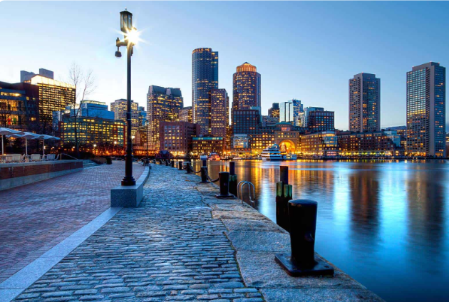
There is something exciting about planning a trip to the United States. Maybe it's because we've all grown up watching American films, seeing pictures of New York, Miami and California, or dreaming about driving down one of those endless highways.
But the USA is one of those destinations where a little preparation can make a big difference.
And it's not always the obvious things that catch people out.
The USA is much bigger than you think
This sounds obvious, but it's probably one of the easiest mistakes to make when planning an American holiday.
You look at a map and think you can squeeze New York, Miami and Los Angeles into the same trip. Technically, you can. Whether you'd actually enjoy spending so much time travelling between them is another question.
Even within the same state, distances can be surprising.
Florida is a good example. Miami, Orlando and Key West might all be on your list, but getting between them involves more travelling than many visitors expect.
The best advice? Don't try to see everything.
Choose a couple of places, give yourself enough time to enjoy them and accept that you'll probably want to come back.
Eating out is a little different
American food is a whole experience in itself.
The portions can be generous, particularly in traditional diners, and there's something quite enjoyable about finding a small local place rather than heading straight for the restaurants you've already heard about.
Breakfast is worth making time for. Pancakes, eggs, crispy bacon and a coffee that keeps getting refilled are part of the classic American diner experience.
But there's one thing worth remembering: the price you see on the menu isn't always the amount you'll actually pay.
Sales tax may be added to the bill, and tipping is an important part of restaurant culture.
For visitors from Europe, this can take a little getting used to.
It's not complicated once you understand how it works, but it helps to know before sitting down for your first meal.
Getting around isn't always straightforward
New York is one of the easier American cities to explore without a car. The subway covers a huge area, and walking is often part of the fun.
Miami is different. Public transport exists, but depending on where you're staying and what you want to visit, having a car can be much more convenient.
Los Angeles is another place where distances can surprise you.
Two attractions that look relatively close on a map can involve a long journey, especially with traffic.
This is why choosing your hotel location matters so much.
Saving a little money on accommodation isn't always worthwhile if you end up spending hours travelling every day.
And if you're renting a car, check the insurance conditions, parking costs and possible toll charges before booking.
Staying connected makes travelling easier
One thing that's easy to overlook when organising a trip is mobile internet.
You might think you'll just use the hotel's Wi-Fi, but that's not much help when you're trying to find your accommodation, check a restaurant, book a taxi or navigate an unfamiliar city.
Having internet access from the moment you arrive can make those first few hours considerably easier.
Many travellers now choose an eSIM instead of buying a physical SIM card after landing.
Services such as Roaming4You or EsimDesti offer travel eSIM options that can be arranged before departure, provided your phone supports the technology.
It's a small detail, but being able to open Google Maps as soon as you leave the airport is genuinely useful.
Don't underestimate the weather
The weather in the United States varies enormously depending on where and when you travel.
Miami can be warm and humid while New York is experiencing cold weather. Head towards the mountains or further north, and conditions can change completely.
Even places associated with sunshine aren't guaranteed perfect weather every day.
Florida, for example, has a hurricane season, which is something worth considering when choosing travel dates.
Checking the typical conditions for your exact destination is much more useful than simply searching for the weather in the USA.
And whatever the forecast says, packing a light jacket is rarely a terrible idea.
Some of the best moments are the simplest
Of course, famous attractions are famous for a reason.
Seeing the Manhattan skyline, walking along Miami Beach or watching the sunset somewhere on the California coast can be memorable.
But a good holiday doesn't have to involve running from one attraction to another.
Sometimes it's the smaller things that make a place interesting.
Stopping for coffee in a neighbourhood you hadn't planned to visit. Walking through a supermarket and discovering products you've never seen before. Finding a little restaurant that's full of locals.
Those ordinary moments often tell you more about a country than the busiest tourist attractions.
It's also worth leaving a few hours unplanned.
Not every minute of a trip needs to be organised.
A few things worth checking before you leave
Before travelling to the USA, make sure you understand the entry requirements for your passport.
Some visitors can use the ESTA travel authorisation system, while others need a visa. It's important to check the official requirements rather than assume the rules are the same for everyone.
Travel insurance is another thing that shouldn't be overlooked.
Medical treatment in the United States can be extremely expensive without suitable coverage, so check what your policy actually includes.
It also helps to have a payment card that works internationally, along with a backup option in case something goes wrong.
Finally, remember that electrical sockets are different from those commonly used in Europe. A suitable adapter is a simple thing to pack and an annoying thing to forget.
Is the USA expensive?
It can be, but it depends enormously on your destination and how you travel.
A week in Manhattan is a very different experience from a road trip through smaller towns.
Accommodation, parking, restaurant bills and attraction tickets can add up quickly.
One practical approach is to decide which experiences really matter to you.
Maybe you want a great hotel location. Maybe you'd rather spend less on accommodation and save the money for an unforgettable activity.
There's no single right way to travel.
Just don't forget to include the smaller expenses in your budget. They're often the ones that surprise people.
Would I recommend travelling to the USA?
There's a reason the United States remains such an appealing destination.
The variety is extraordinary. Big cities, beaches, mountains, deserts, national parks and small towns all offer completely different experiences.
You could visit several times and still feel that you've barely scratched the surface.
The trick is not to treat the whole country as one enormous checklist.
Pick somewhere that genuinely interests you, give yourself enough time and don't worry too much about seeing absolutely everything.
You can always save something for another trip.
And sometimes having a reason to come back is part of the fun.
There is something exciting about planning a trip to the United States. Maybe it's because we've all grown up watching American films, seeing pictures of New York, Miami and California, or dreaming about driving down one of those endless highways.
But the USA is one of those destinations where a little preparation can make a big difference.
And it's not always the obvious things that catch people out.
The USA is much bigger than you think
This sounds obvious, but it's probably one of the easiest mistakes to make when planning an American holiday.
You look at a map and think you can squeeze New York, Miami and Los Angeles into the same trip. Technically, you can. Whether you'd actually enjoy spending so much time travelling between them is another question.
Even within the same state, distances can be surprising.
Florida is a good example. Miami, Orlando and Key West might all be on your list, but getting between them involves more travelling than many visitors expect.
The best advice? Don't try to see everything.
Choose a couple of places, give yourself enough time to enjoy them and accept that you'll probably want to come back.
Eating out is a little different
American food is a whole experience in itself.
The portions can be generous, particularly in traditional diners, and there's something quite enjoyable about finding a small local place rather than heading straight for the restaurants you've already heard about.
Breakfast is worth making time for. Pancakes, eggs, crispy bacon and a coffee that keeps getting refilled are part of the classic American diner experience.
But there's one thing worth remembering: the price you see on the menu isn't always the amount you'll actually pay.
Sales tax may be added to the bill, and tipping is an important part of restaurant culture.
For visitors from Europe, this can take a little getting used to.
It's not complicated once you understand how it works, but it helps to know before sitting down for your first meal.
Getting around isn't always straightforward
New York is one of the easier American cities to explore without a car. The subway covers a huge area, and walking is often part of the fun.
Miami is different. Public transport exists, but depending on where you're staying and what you want to visit, having a car can be much more convenient.
Los Angeles is another place where distances can surprise you.
Two attractions that look relatively close on a map can involve a long journey, especially with traffic.
This is why choosing your hotel location matters so much.
Saving a little money on accommodation isn't always worthwhile if you end up spending hours travelling every day.
And if you're renting a car, check the insurance conditions, parking costs and possible toll charges before booking.
Staying connected makes travelling easier
One thing that's easy to overlook when organising a trip is mobile internet.
You might think you'll just use the hotel's Wi-Fi, but that's not much help when you're trying to find your accommodation, check a restaurant, book a taxi or navigate an unfamiliar city.
Having internet access from the moment you arrive can make those first few hours considerably easier.
Many travellers now choose an eSIM instead of buying a physical SIM card after landing.
Services such as Roaming4You or EsimDesti offer travel eSIM options that can be arranged before departure, provided your phone supports the technology.
It's a small detail, but being able to open Google Maps as soon as you leave the airport is genuinely useful.
Don't underestimate the weather
The weather in the United States varies enormously depending on where and when you travel.
Miami can be warm and humid while New York is experiencing cold weather. Head towards the mountains or further north, and conditions can change completely.
Even places associated with sunshine aren't guaranteed perfect weather every day.
Florida, for example, has a hurricane season, which is something worth considering when choosing travel dates.
Checking the typical conditions for your exact destination is much more useful than simply searching for the weather in the USA.
And whatever the forecast says, packing a light jacket is rarely a terrible idea.
Some of the best moments are the simplest
Of course, famous attractions are famous for a reason.
Seeing the Manhattan skyline, walking along Miami Beach or watching the sunset somewhere on the California coast can be memorable.
But a good holiday doesn't have to involve running from one attraction to another.
Sometimes it's the smaller things that make a place interesting.
Stopping for coffee in a neighbourhood you hadn't planned to visit. Walking through a supermarket and discovering products you've never seen before. Finding a little restaurant that's full of locals.
Those ordinary moments often tell you more about a country than the busiest tourist attractions.
It's also worth leaving a few hours unplanned.
Not every minute of a trip needs to be organised.
A few things worth checking before you leave
Before travelling to the USA, make sure you understand the entry requirements for your passport.
Some visitors can use the ESTA travel authorisation system, while others need a visa. It's important to check the official requirements rather than assume the rules are the same for everyone.
Travel insurance is another thing that shouldn't be overlooked.
Medical treatment in the United States can be extremely expensive without suitable coverage, so check what your policy actually includes.
It also helps to have a payment card that works internationally, along with a backup option in case something goes wrong.
Finally, remember that electrical sockets are different from those commonly used in Europe. A suitable adapter is a simple thing to pack and an annoying thing to forget.
Is the USA expensive?
It can be, but it depends enormously on your destination and how you travel.
A week in Manhattan is a very different experience from a road trip through smaller towns.
Accommodation, parking, restaurant bills and attraction tickets can add up quickly.
One practical approach is to decide which experiences really matter to you.
Maybe you want a great hotel location. Maybe you'd rather spend less on accommodation and save the money for an unforgettable activity.
There's no single right way to travel.
Just don't forget to include the smaller expenses in your budget. They're often the ones that surprise people.
Would I recommend travelling to the USA?
There's a reason the United States remains such an appealing destination.
The variety is extraordinary. Big cities, beaches, mountains, deserts, national parks and small towns all offer completely different experiences.
You could visit several times and still feel that you've barely scratched the surface.
The trick is not to treat the whole country as one enormous checklist.
Pick somewhere that genuinely interests you, give yourself enough time and don't worry too much about seeing absolutely everything.
You can always save something for another trip.
And sometimes having a reason to come back is part of the fun.
0 Replies
·
34 views

Hey adventure-seekers! Plan your Dubai getaway between November and March for optimal weather and endless fun. From iconic sights to desert safaris and yacht cruises, there's something for everyone. Don't miss the heart-pounding excitement of dune buggy adventures in the desert! Keep in mind, peak season means larger crowds and higher prices, but shoulder months like April and October offer a bit more elbow room. Get ready for the ultimate Dubai adventure!

8 Replies
·
3067 views
Hi everyone!
Happy to be part of this community! I enjoy discovering new destinations, finding useful travel tips and learning from other travellers.
Looking forward to sharing ideas, getting recommendations and joining some interesting discussions.
Greetings from New york.
Happy to be part of this community! I enjoy discovering new destinations, finding useful travel tips and learning from other travellers.
Looking forward to sharing ideas, getting recommendations and joining some interesting discussions.
Greetings from New york.
3 Replies
·
161 views