Roads of Adventure safaris
info@roadsofadventuresafaris.comThis 10 Days White water rafting, Gorilla trekking & Mountain Rwenzori hike itinerary delivers a premier East African adventure. Spanning distinct geographic regions in Uganda, you will experience aquatic challenges, deep forest explorations, and high-altitude alpine zones. Beginning with the roaring rapids of the Victoria Nile in Jinja, the route moves west across the country to the glacial peaks of the Rwenzori range. After traversing moss-draped valleys, alpine bogs, and high mountain passes, the trail leads south to the dense rainforests of Bwindi Impenetrable National Park. Every stage exposes key ecological zones and local cultures, combining white water navigation, high-altitude mountaineering, and rare wildlife tracking into one continuous journey. Here is the day-by-day breakdown of this expedition.
Day 1: Arrival & Travel to Jinja
Your expedition begins upon arrival at Entebbe International Airport (EBB). You meet your driver-guide in the arrivals area and board a 4x4 safari vehicle to start the journey eastward to Jinja. The route covers approximately 120 kilometers along the Kampala–Jinja Highway, taking between 3 to 4 hours depending on traffic flow through Kampala and Mukono. Along the way, you cross the Source of the Nile Bridge, an impressive cable-stayed bridge spanning the Victoria Nile. You travel through lush sugarcane plantations and the Mabira Forest Reserve, catching your first glimpses of rural Ugandan life. Upon reaching Jinja town—historically recognized as the adventure capital of East Africa—you check into your hotel along the riverbanks. The remainder of the afternoon is spent unwinding, receiving a comprehensive briefing on your upcoming itinerary, and preparing gear for the river excursion scheduled for the following morning.
Day 2: Nile White Water Rafting
After an early breakfast, you transfer to the activity staging point at Kangulumira along the Victoria Nile, downriver from the Nalubaale Power Station. Here, professional river guides conduct a thorough safety briefing, covering paddle commands, rescue maneuvers, and emergency protocols. You board self-bailing rafts to navigate a iconic 21-kilometer stretch of river featuring Grade 4 and Grade 5 rapids, including famous runs known as Overtime, Retaker, and Bad Place. Calm pools between the rapid sets allow you to swim and observe native bird species like the African Fish Eagle and Pied Kingfisher along the riverbanks. Safety kayaks accompany the expedition throughout the water journey to ensure maximum operational security. After clearing the final rapids, the float ends at the takeout point near Kalagala Falls. You enjoy a riverside lunch before transferring back to your Jinja lodge for dinner and rest.
Day 3: Transfer to Kasese
You check out of your Jinja hotel early in the morning for a long cross-country transit west toward Kasese town, the primary gateway to the Rwenzori Mountains. Driving southwest via the Fort Portal route, you cover roughly 450 kilometers over 8 to 10 hours. The highway winds through the undulating hills of central Uganda, past tea estates in the Tooro Kingdom, and across traditional trading centers. As you approach Fort Portal and head south toward Kasese, the massive fault-block wall of the Rwenzori Range begins to dominate the western horizon. You cross the equator line near Kasese District, entering the Albertine Rift Valley system. Upon arrival in Kasese town (elevation 1,290 meters), you check into your hotel. You meet your Rwenzori Mountaineering Services (RMS) head guide for a mandatory gear check and packing preparation.
Day 4: Nyakalengija to Nyabitaba Hut
Following breakfast, you drive 22 kilometers from Kasese to the park headquarters in Nyakalengija (1,615 meters). You register with the Uganda Wildlife Authority (UWA), meet your team of local Bakonzo porters and armed park rangers, and receive a safety orientation. The trek begins along the Central Circuit trail, passing through agricultural land and homesteads along the Mobuku River. Entering the Rwenzori Mountains National Park boundary, the trail ascends steeply through dense montane forest and elephant grass, crossing the Mahoma River. Keep watch for blue monkeys and Rwenzori turacos along the canopy. The 10-kilometer hike requires 5 to 6 hours of steady walking, gaining roughly 1,036 meters of elevation. You reach Nyabitaba Hut (2,651 meters) situated on a forest ridge by late afternoon, where you settle in for dinner and your first overnight stay on the mountain.
Day 5: Nyabitaba to John Matte Hut
You depart Nyabitaba Hut, descending through forest trails to cross the Kurt Shafer Bridge spanning the confluence of the Mobuku and Bujuku rivers at 2,300 meters. From the bridge, the trail climbs steeply through bamboo zone terrain and slippery moss-covered rocks toward the Nyamuleju rock shelter. Here, clear weather offers views of Mount Stanley and Mount Speke in the distance. You enter the giant heather forest zone, where trees are blanketed in thick Spanish moss and lichens. The trail leads into the lower Bigo Bog, requiring careful footwork across wooden boardwalks and tussocks to navigate the muddy terrain. This 11-kilometer leg takes 6 to 7 hours of hiking. You arrive at John Matte Hut (3,505 meters) located near the Bujuku River. The evening temperature drops significantly at this altitude, requiring warm thermal layers.
Day 6: John Matte to Bujuku Hut
The trek from John Matte Hut crosses the demanding Upper Bigo Bog via a series of wooden boardwalks designed to protect the fragile alpine ecosystem. Giant lobelias and giant groundsels (Dendrosenecio adnivalis) line the path, presenting a unique afro-alpine botanical environment. As you clear the bog, the trail climbs toward Lake Bujuku (3,900 meters), a glacial lake nestled in the valley between Mount Speke, Mount Stanley, and Mount Baker. You trek along the lake's marshy shores, navigating mud pools and rock slabs to reach Bujuku Hut (3,962 meters). This 5-kilometer leg takes 5 to 6 hours due to the elevation gain and technical terrain. Bujuku Hut serves as a key high-altitude base, offering stark views of surrounding glaciers and vertical rock walls. You rest early to aid acclimatization for the high pass ahead.
Day 7: Bujuku to Kitandara Hut
Leaving Bujuku Hut, you head south through the swampy Groundsel Gully, ascending steeply toward the highest non-peak point of the Central Circuit. You navigate metal ladders and fixed cables anchored into the rock faces to negotiate vertical sections. The climb culminates at Scott Elliot Pass (4,372 meters), which opens onto views of Mount Baker, Margherita Peak, and the surrounding glaciers. After taking time to rest and photograph the pass, you begin a steep descent down a scree slope toward the Kitandara Valley. The trail leads past the Upper and Lower Kitandara Lakes. This 6-kilometer segment takes 6 to 7 hours of demanding mountain travel. You reach Kitandara Hut (4,023 meters), tucked beside the lower lake beneath the shadow of Mount Luigi di Savoia, for dinner and overnight.
Day 8: Kitandara to Guy Yeoman Hut
The trail from Kitandara starts with a steep morning climb up to Freshfield Pass (4,282 meters), traversing open alpine moss, scree, and exposed rock faces. From the pass, views extend west into the Democratic Republic of the Congo on clear days. You then begin a long, continuous descent into the Mubuku River valley. The path passes through the Kabamba rock shelter at 3,450 meters before descending further into the giant heather zone. Wet bog sections and steep, slippery mud gullies require careful footing and trekking poles throughout the descent. The day's route covers approximately 6 kilometers over 6 hours. You reach Guy Yeoman Hut (3,505 meters), located in a wide valley along the Mubuku River, where you spend your final night on the mountain circuit.
Day 9: Guy Yeoman to Nyakalengija & Transfer to Bwindi
You complete the final leg of the mountain circuit, descending steeply from Guy Yeoman Hut along the Mubuku River banks. The trail passes Kichuchu rock shelter and winds down through the bamboo and montane forest zones, crossing wooden bridges back to Nyabitaba. From Nyabitaba, you cover the final descent back to the park gates at Nyakalengija (1,615 meters). This 5-hour trek ends with a certificate ceremony hosted by the Rwenzori Mountaineering Services team. After tipping your porters and guides, you meet your vehicle for the 180-kilometer drive south to Bwindi Impenetrable National Park. The 5 to 6-hour road trip passes through the Ishasha sector of Queen Elizabeth National Park and rural highlands before arriving at your lodge near the Buhoma or Ruhija sector of Bwindi.
Day 10: Gorilla Trekking & Departure
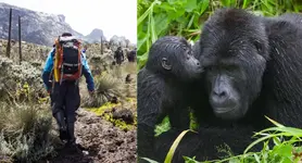
You wake early for a 7:30 AM arrival at the Bwindi Impenetrable National Park visitor center. UWA rangers conduct a mandatory briefing on gorilla etiquette, safety distance rules, and rainforest conservation protocols. You are assigned to a specific habituated mountain gorilla family and grouped with up to seven other trekkers. At 8:00 AM, you enter the thick jungle alongside armed rangers and trackers, cutting through dense foliage, steep ravines, and muddy slopes. Treks vary from 2 to 6 hours depending on where the family nested the previous night. Once located, you spend exactly one hour observing the gorillas as they feed, groom, and interact. Afterwards, you return to the trailhead to collect your trekking certificate before transferring to Entebbe International Airport or Kigali International Airport in Rwanda for your evening departure flight.